Category Archives: Nasa

The World Below: Time-Lapse | Earth 2 from Bruce W. Berry Jr

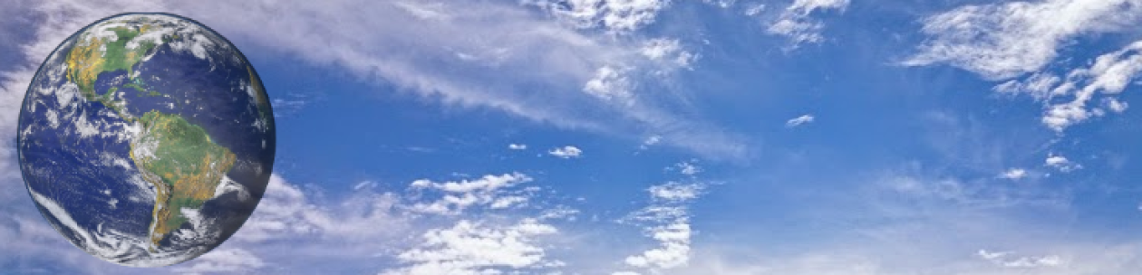
The World Below: Time-Lapse | Earth 2 from Bruce W. Berry Jr on Vimeo.

I never thought that I’d be making another one of these, but with all of the new footage from the International Space Station (ISS) that has been made public, I decided to give it another go.

All of 4K video and Time-lapse sequences were taken by the astronauts onboard the ISS (NASA/ESA). All footage has been edited, color graded, denoised, deflickered, stabilized by myself. Some of the 4K video clips were shot at 24frames/sec reflecting the actual speed of the space station over the earth. Shots taken at wider angels were speed up a bit to match the flow of the video.

Some interesting facts about the ISS: The ISS maintains an orbit above the earth with an altitude of between 330 and 435 km (205 and 270 miles). The ISS completes 15.54 orbits per day around the earth and travels at a speed of 27,600 km/h; 17,100 mph).

The yellow line that you see over the earth is Airgolw/Nightglow. Airglow/Nightglow is a layer of nighttime light emissions caused by chemical reactions high in Earth’s atmosphere. A variety of reactions involving oxygen, sodium, ozone, and nitrogen result in the production of a very faint amount of light (Keck A and Miller S et al. 2013).

Hope you enjoy and thank you all again for watching!

Music: “Journey to the Line” composed & performed by “Hans Zimmer”
All rights reserved to their respective owners.

Edited by: Bruce W. Berry Jr. @ Website: |Bruce Wayne Photography|

Time-Lapse Image Courtesy of the Earth Science and Remote Sensing Unit, NASA Johnson Space Center
https://eol.jsc.nasa.gov/BeyondThePhotography/CrewEarthObservationsVideos/

4K video Courtesy of NASA
https://www.nasa.gov/content/ultra-high-definition-video-gallery

Last clip: imagery courtesy of the European Space Agency
Credit: NASA/ESA/M.Kornmesser
https://www.eso.org/public/videos/earth_2015_4k/

Footage Note: The slower video represents true speed of the ISS or was shot in 4K at 24fps. These clips are all marked with an *. Unfortunately I do not know all of the locations of the shots as many files did not have a name on them and just the mission numbers.

Locations of Footage in the order they appear:

1. Kounotori 4, unmanned cargo spacecraft *
2. Unknown*
3. Quebec City, Canada
4-7. Unknown*
8. Ucayali River, Peru*
9. Unknown*
10. Quebec City and St. Lawrence River, Canada*
11-12. Unknown*
13. Western United States*
14. Unknown*
15. Ataturk Dam Lake, on the Euphrates River, Turkey *
16. Nile River, lower Egypt*
17. Dubai, United Arab Emirates*
18. Bahamas*
19. The Nile Delta, Egypt*
20. Texas Gulf Coast*
21. Unknown*
22. Unknown
23. Aurora Borealis over North America
24. Aurora Borealis over Canada and USA
25. Iberian Peninsula to Red Sea
26. Southern Hemisphere Aurora and Sunrise
27. The Nile River Delta to Mecca, Middle East
28. Mexico to Maine, USA
29. Balearic Sea to Lake Turkana
30. Atlantic Ocean to Kazakhstan
31. Aurora Borealis over the Atlantic Ocean
32. The Earth and sunrise in 4K

https://www.bruce-wayne-photography.com/

Earthrise: A Video Reconstruction

By: APOD Videos

Published on Dec 18, 2018

Credit: NASA, SVS, Apollo 8 Crew Lead Animator: Ernie Wright (USRA) Music: C Major Prelude by J. S. Bach

Details: https://svs.gsfc.nasa.gov/4129

From Astronomy Picture of the Day:

https://apod.nasa.gov/apod/ap181223.html

A highly recommended website


The Earth in Stunning 4K UHD

By:   Space Videos

Can’t get enough of Earth?

Then this is for you: an extended playback of Ultra High Definition views of Planet Earth, captured by NASA astronaut Jeff Williams during his mission on the International Space Station in 2016. You’ll see the French Riviera and the Sahara Desert, cross North America from Texas all the way to Canada, and more—this is your source for the view of your home planet from 250 miles up! Fire up the biggest screen you have. Then throw on your favorite music, kick back and watch. UHD download link: https://archive.org/details/NASA-Ultr

Subscribe For More Videos Like This:

http://www.youtube.com/user/ouramazin… See my latest videos :

https://www.youtube.com/user/ouramazi… Bringing you the BEST

Space and Astronomy videos online. Showcasing videos and images from the likes of NASA,ESA,Hubble etc. Join me on Facebook:

https://www.facebook.com/spaceisamazing Twitter:

https://twitter.com/AmazingSpace2 Google+ :

http://goo.gl/1WCBn9 Music by Keving Macleod

http://incompetech.com/music/royalty-…

Jeff’s Earth


By: NASA Johnson

Originally published on Dec 29, 2016

The first time you see Planet Earth from space, it’s stunning; when you’ve spent 534 days in space—more than any other American—it still is! On his most recent trip the International Space Station NASA astronaut Jeff Williams used an Ultra High Definition video camera that he pointed at the planet 250 miles below; here he shares some of those images, and talks about the beauty of the planet, the variety of things to see, and the value of sharing that perspective with everyone who can’t go to orbit in person.

HD download link: https://archive.org/details/TheSpaceP…

UHD content download link: https://archive.org/details/NASA-Ultr…
_______________________________________

FOLLOW THE SPACE STATION!

Twitter: https://twitter.com/Space_Station
Facebook: https://www.facebook.com/ISS
Instagram: https://instagram.com/iss/

Top 16 Earth Images of 2016 ISS


By: NASA Johnson

Originally published on Dec 19, 2016

Astronauts on the International Space Station take pictures of Earth out their windows nearly every day; over a year that adds up to thousands of photos. The people at the Earth Science and Remote Sensing Unit at NASA’s Johnson Space Center in Houston pored through this year’s crop to pick the top 16 photos of Earth for 2016—enjoy!

HD download link: https://archive.org/details/TheSpaceP…
_______________________________________
FOLLOW THE SPACE STATION!

Twitter: https://twitter.com/Space_Station
Facebook: https://www.facebook.com/ISS
Instagram: https://instagram.com/iss/

NASA Astronaut Jeff Williams Celebrates the National Park Service Centennial from the International Space Station


By: NASA Johnson

Originally Published on Aug 25, 2016

NASA Astronaut Jeff Williams shares his photos and personal stories as he celebrates the 100th anniversary of the National Park Service. Jeff’s affection for the National Parks began when he was a child. His father was a seasonal park ranger severing at Devils Tower National Monument. Now, his unique vantage point on the International Space Station provides an endless panorama of the natural beauty and awesome grandeur that is found in the National Parks.
_________________________________
FOLLOW JEFF WILLIAMS!

Facebook: https://www.facebook.com/NASAAstronau…

Twitter: https://twitter.com/astro_jeff

Instagram: https://www.instagram.com/astro_jeffw/

One Year on Earth – Seen From 1 Million Miles


By: NASA Goddard

Originally published on Jul 20, 2016

On July 20, 2015, NASA released to the world the first image of the sunlit side of Earth captured by the space agency’s EPIC camera on NOAA’s DSCOVR satellite. The camera has now recorded a full year of life on Earth from its orbit at Lagrange point 1, approximately 1 million miles from Earth, where it is balanced between the gravity of our home planet and the sun.

EPIC takes a new picture every two hours, revealing how the planet would look to human eyes, capturing the ever-changing motion of clouds and weather systems and the fixed features of Earth such as deserts, forests and the distinct blues of different seas. EPIC will allow scientists to monitor ozone and aerosol levels in Earth’s atmosphere, cloud height, vegetation properties and the ultraviolet reflectivity of Earth.

The primary objective of DSCOVR, a partnership between NASA, the National Oceanic and Atmospheric Administration (NOAA) and the U.S. Air Force, is to maintain the nation’s real-time solar wind monitoring capabilities, which are critical to the accuracy and lead time of space weather alerts and forecasts from NOAA.

For more information about DSCOVR, visit: http://www.nesdis.noaa.gov/DSCOVR/

If you like this video, subscribe to the NASA Goddard YouTube channel: https://www.youtube.com/goddardtv

Credit: NASA’s Goddard Space Flight Center/Kayvon Sharghi

This video is public domain and along with other supporting visualizations can be downloaded from the Scientific Visualization Studio at:http://svs.gsfc.nasa.gov/12312

Follow NASA’s Goddard Space Flight Center on:

Facebook: https://www.facebook.com/NASA.GSFC

Twitter: https://twitter.com/NASAGoddard https://twitter.com/NASAGoddardPix

Flickr: https://www.flickr.com/photos/gsfc/

Instagram: https://www.instagram.com/nasagoddard/

Google+: https://plus.google.com/+NASAGoddard/…

Rising CO2 Levels Greening Earth


By: NASA Goddard

Originally published on Apr 26, 2016

From a quarter to half of Earth’s vegetated lands has shown significant greening over the last 35 years largely due to rising levels of atmospheric carbon dioxide, according to a new study published in the journal Nature Climate Change on April 25. The greening represents an increase in leaves on plants and trees equivalent in area to two times the continental United States.

Credit: NASA’s Goddard Space Flight Center/Kayvon Sharghi

This video is public domain and may be downloaded at:
http://svs.gsfc.nasa.gov/12222

Like our videos? Subscribe to NASA’s Goddard Shorts HD podcast:
http://svs.gsfc.nasa.gov/vis/iTunes/f…

Or find NASA Goddard Space Flight Center on Facebook:
http://www.facebook.com/NASA.GSFC

Or find us on Twitter:
http://twitter.com/NASAGoddard